 BEST WESTERN ADVENTURES
Series 14
MT HOOD DON'T RAIN ON MY PARADE
I was dreaming of mountains. Great big snow covered mountains. Large looming jagged mountains. Hiking on wet brown Pacific Northwest trails hunting big ole ammo cans with lots o swag. It was this dream that was getting me through the frustrating parts of our vacation. We had to get there first, and to that end, I sacrificed a lot of geocaching opportunities along the way in the interest of time. We stopped when it was convenient to, when kids needed to get out to stretch their legs.
We stopped once just south of Bend at a cache called Frozen Fire, which I really wish I had gotten pictures at. I had to walk across lava rocks for 400 feet before making the find, which was tricky traveling. We made a quick stop in Bend at one called Aspen Cove, where I picked up a travel bug. We also stopped for a late lunch/early dinner at a fast food joint that makes me nostalgic for my childhood, Del Taco. I have never seen one of these since the eighties except here in Bend, and we hit it every visit.
 me nostalgic for my childhood, Del Taco. I have never seen one of these since the eighties except here in Bend, and we hit it every visit.
After Bend, we headed north and visited an interesting virtual in Madras, a park and grab in a neighborhood in Terrebonne, and one weird virtual/micro near a hiking trail while driving through the Warm Springs Indian Reservation, which encompasses over 1000 sq miles in North Central Oregon.
But still I was holding out, passing them by, because I had about twelve caches downloaded for the Mt Hood area. I was waiting until we reached Government Camp to really let the geocaching hammer fall. I wanted to get twenty along the trip to the airport, with twelve of those being in the Mt Hood National Forest.
Oh, I had great, grandiose expectations. Expectations that were soon dashed with a splash...of rain...some drops...a s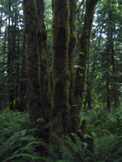 prinkling, a general misting...a general splashing....
 prinkling, a general misting...a general splashing....
I can still cache in this, I kept saying, I'm not going to melt or anything. I don't care about getting wet....
Until I tried, and realized that this rain was not like Texas rain. It was heavier, and it dripped down from the ferns and greenery, making trails slushy and shoes soggy. I needed Gortex and hiking boots, not tennis shoes and t-shirts. I needed satellite reception and help with finds, not a "lost reception" message on the GPS unit and a husband who refused to bring kids out of the car and hunt with me. I needed to feel relaxed and confident, and not feel afraid of a predator around every twist in the trail.
I needed to make a find. The first one I tried I panicked and came running back down the trail to the car. Let's just go, I said, breathless and scared. The rain came down harder. You really want to do this? my husband asked me with a you-must-be-crazy look.
Rain poured from the sky, windshield wipers working furiously and falling behind. Cars behind us and in front of us prevented the sudden stops and turns that us geocachers sometimes commit in our particular pursuit (wait, turn here...now!). I passed up more.
And you couldn't even see the mountains for the fog. We drove right past Mt Hood and never..even...saw...it.
I began to realize that my plans were going downhill, while we continued to travel up. I had to make some adjustments. I settled on two finds that I absolutely did not want to give up.
One was an ammo can in the forest, not far from the road, outside a "park". I was thinking playground, etc, but in this case, "park" was akin to wilderness area. I wanted to go after this one because it supposedly had a geocoin in it that wanted to go to Texas. I had posted a note that I wanted to grab that coin. 

As soon as I got on to the trail, following my compass that said "350 feet", I lost reception. I could no longer rely on the GPS unit to get me close. I kept walking thinking I could guesstimate the distance and use the clue I was given - "Left side of trail next to uprooted tree".
Turns out there were many things that sort of fit the clue, and the trail split off several times. Finally after I almost felt like giving up, I found what exactly resembled the clue right as I got reception back and my GPS unit said I was within "24 feet". Cool! The geocoin was gone, though, darn it. A Red Jeep travel bug was left in its place, which of course, I took.
The trail was beautiful, though, in a surrealistic manner. I had never been in this kind of forest before and it took my breath away.
After this, I let go of any other caching opportunities in expectation of The Great Big Find - the site of the Original Geocache.
This involved a detour off the highway to a town called Estacada. This is where the great game of geocaching got its start, when Dave Ulmer hid a bucket in the woods and advertised it to his techno-geeky friends on their forum about possible civilian uses of GPS technology. This was in May of 2000, and by the end of that year, there were 75 "geo stashes", as they were called then, in America. Today, eight years later, there are 648, 741 geocaches listed on http://www.geocaching.com./ They are hidden all over the world by all types of people in all kinds of places. All you need is a GPS unit and a sense of adventure to find them.
Finding the site of the Original Stash Tribute Plaque was not hard. It was right there by the side of a road in the middle of nowhere, several christmas farms past Estacada. There is a nearby ammo can with the original log. Although the original cache is no longer there, having been destroyed by a lawnmower, this replacement cache has been up and running for five years, and is the geocache with the most number of logged finds, at 2075 logged visits. It is one of the three most popular caches, a part of the "Northwest Trifecta" that also includes the APE cache and Groundspeak Headquarters in Seattle.
There is also another historic old cache nearby, the Un-Original Stash, and I was going to get that one, too, while we were there. I kept trying but as soon as I got on the trail, it was pitch-dark in there and I couldn't make the find without a flashlight. It was, after all, nearly nine pm by this time. My husband and I got into a terrible row about it because he didn't want me to get the flashlight to get it and he didn't want to watch the kids for me because he was too enthralled with the Original Stash. Here I am the geocacher in the family, and he is the one pawing through the ammo can, ooh-ing and aww-ing over old log books, traveling items, and swag trades.
However, I did have time there to do one silly little thing. They say that if you place your GPS units on the plaque, you will have extended battery life and super-accurate satellite reception afterwards.
So here's to luck, to myths, and to better caching days ahead....


1 comment:
Hi,
This is impressive with the original stash! Let me know how battery thing works. LOL!
Yes, both of my sons are at Lejeune. I know how you feel. Every war is hard, but this one has been particularly hard for the families, I think, because we're so spread out. My husband was in the Reserves during the early part of things and was gone for the better part of three years straight. It was a very hard time for all of us. The boys were deployed at the same time in Anbar and that was horrible. We did get through it though and, when I see what they have accomplished over there, I am proud of all of us, not because we did our "duty", but because we did the right thing in a time when the right thing isn't easy to do. In the end, our ability to stand and do that has made the difference for our children and grand children.
I hope so, at least.
Happy wanderings!
The Writer...and her dog, Bear
Post a Comment