 ADVENTURES IN CACHING
FOUR CACHE LOOP
Sam Houston National Forest
New Waverly, Texas
It was a brisk fall Saturday. I rose before the sunrise and was on my way shortly after six to meet with some friends from the Houston Geocaching Society (HGCS) Forums. We had planned a group run at a cache called Four Cache Loop, a four part multi in the Sam Houston National Forest that required a ten mile hike through the woods.
In geocacing speak, we would say, "and all that for one smiley!" When we log our finds online, there is a smiley next to our "found it" logs. Some smileys are easier to obtain that others. This one was reputed to be the most difficult smiley to obtain in the greater Houston area (albeit pretty far from Houston itself). Last year, it was voted "Most Physically Challenging" and "Best Multi-Cache" in the Cacher's Choice aspect of HGCS's first Annual Geocaching Awa
 rds. It is a rite of passage for cachers in this area, an epic find that is best done with a group. Upon completing the journey, the final waypoint includes patches that say "I Conquered Four Cache Loop".
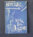
Once I left the house, I had a "duh" moment when I realized I was leaving two hours before the meeting time, to get to a place that was an hour away. I decided I would just get there early and sleep until the rest of the group got there, but as it turns out, I needed that extra time because I got lost. I took a very odd way there, basically chucking out the directions I had in order to go "the scenic route", which ended with me getting lost on the backroads of New Waverly. I was fine with it, really, because it gave me time to drive around the farmlands of this tiny town and try to imagine where William Burroughs lived during his time here. Burroughs was a "Beat", a friend of Jack Kerouac's, and his family had purchased a farm out here to keep him out of trouble. As it turns out, he turned it into a marijuan
 a farm and his wife was addicted to Benzedrine during this time, so I am not sure it turned out the way his family wanted. I try to imagine Burroughs, always dressed finely in his nice suit, out here tilling the earth and blending in with the farmers at the feed store.
Finally I ended up at the dirt road that lead to the Hunter's Camp parking area, and got there at the exact time we were due to meet, meeting one carload of three by about fifteen minutes.
Our group this morning consisted of seven people, five men and two women. One was a cacher, HoustonControl, who had done this cache before, three times. He acted as our guide, and kept us on the trail, marked by little tags on the trees.
Originally, we had wanted to do this hike during October, before hunting season started, but the forest was closed due to damage by Hurricane Ike. As we hiked, we saw evidence of Ike's damage in uprooted trees and fallen logs that had been cut and moved off the trail. The trail itself was not that easily visible, and a few times we found ourselves looking for markers because the trail itself was unclear.
One of the hazards of the trail were the many water crossings. We probably crossed creeks about thirty times during the course of our hike, and jok
 ed about what number we were probably on in the later ones. I didn't get my shoes wet, nor did I fall down during any of this, and I am pretty proud about that because there were times I thought I might do either.
I did trip a lot, and stumble over sticks and roots in the path. I have about three scratches on my legs now, midway up, from branches that broke under my feet and came back up and grabbed my legs. My long pants seemed to be catching on everything.
It was about 45 degrees when we started, and as the sun rose, it might have gotten into the seventies. It was a nice cool day, which helped about halfway through when our sweat just lifted off of us. The first waypoint wasn't too hard to get to, even though it is off the trail aways. It would have been hard to find this one on my own. I got to open it because I was on the right side of the creek. I read the next set of coordinates off the laminated card for the others to input into their GPS unit.
I was really impressed with the unit Freysman carried. It was a Garmin Nuvi, a driving unit to mount on your console, but also portable and accurate on the trail He said that the only drawback he found was that the batte
 ry has to recharged, not replaced, and the life seems to be only about five and a half hours. That is how long our hike took, and he mentioned that he was wondering if it would make it the whole way, so he was turning it off when he could. I forgot to ask him when we finished if it was still running or not.
The pace early on was medium to fast, with Sky Rookie primarily leading the group. We were all able to talk with a minimal amount of exertion on this part of the journey. Midway through the trip to the second waypoint, I was begining to feel how long this journey would be. HoustonControl (Larry) said something like "It's only two miles," and I felt relieved actually we had gone that far, only then to feel disheartened by him finish with, "to the next waypoint."
The second waypoint was a quick dash and grab, with SkyRookie doing the honors this time. A hunter was walking down our trail, and had stopped to talk to Larry, who was standing at the edge of the trail waiting for us to come back. I walked over and was intrigued by the man's compound bow. He was telling Larry to make sure we were wearing lots of "hunter orange", because he didn't trust "those yo-hos from Houston". We chuckled about this later.
We had our GPS u
 nits re-set for the third waypoint now, 1.92 miles away. There was little talking and a fast pace now. I starting stumbling more than usual now, and reached into my pack as we walked for a snack and some water. Once my blood sugar started coming back up, I was able to be less clumsy.
We stopped about 0.40 from the third waypoint for lunch. Before we ate, though the six of us that had not been on this journey before had to walk 0.30 mile down the trail to find the final waypoint of a puzzle cache called D.B. Cooper Jr. The cache itself was great. If you know the story of D.B. Cooper, just think about how it probably ended....and you get the picture.
We sat down in the middle of the old dirt road and ate our lunch. Freysman had an MRE he was excited about, which got us on the subject of Hurricane Ike. HoustonControl talked about a WhereIGo cache he was working on developing.
After lunch, we shortly reached the third waypoint. During our half day journey, we all discussed various geocaches, found and unfound, puzzles we were having a hard time with, waypoints to multis that had stumped us. We picked each other's brains about equipment and hints to solving projections and puzzles.
 Voodoo Chicken and I talked about the strugggle for women to keep their identity when they become mothers. Larry told us stories of entertaining himself while growing up in an isolated rural area. We got to know each other's history, little bits like where people went to school and what they studied, heard their lost dreams. Freysman, I'll always think of you as the monk on the mountain ;)
After the third waypoint was found, read, and the final coords loaded into our units, we were off again for this last 1.26 miles (I think) stretch. We were hoofing it pretty fast and finally HoustonControl asked SkyRookie to stop for a few and let us take a break. I was walking in the rear of the line now, with (Mr) MTCachers and freysman, whose leg was giving him some trouble. VoodooChicken walked with us until we reached the waypoints, when she gleefully ran ahead to try to beat Sky Rookie to the find. HoustonControl rotated between bringing up the rear, riding it out on the middle, or loping along in front with Sky Rookie, with JimJoCourt on his heels. It was a good group to be with.
Finally we found the fourth and final waypoint, at which lay an ammo can with some Jeep travel bugs, another regular travel bug, the patches, and some swag and pins. We all signed the logbook and took this group photo. Great fun!
In the end, it turns out the whole loop plus the side journey to DB Cooper brings it to an 11.5 mile hike through varied terrain. The parking lot was only about 0.30 miles from the final, which was about the worse part of the journey for me. I had a blister on my toe and the back of my heel, and was bringing up the rear by that point.
I actually managed to do another geocache on the way home that was about 500 painful feet from the car, and then meet some old friends for a late lunch. But boy was I sore that night!


2 comments:
Love it! Been there done that getting lost while you have a GPS with you.
Electronic Breadcrumbs
Sounds like, at least, it was a ton of fun. ;)
A 'lil HooHaa
Post a Comment